Testing SuperCatch with your club? Start here
SuperCatch
New Zealand · Australia · Lord Howe to Fiji

Live ocean data for fishing.

Sea temperature every hour, chloro from the satellites, and sea height and wind four days ahead - across New Zealand, Australia and the Pacific from Lord Howe to Fiji - with a marine chart underneath in New Zealand waters. On your phone.

  • Hourly 2 km sea temperature
  • Fifteen coverage boxes
  • iPhone app and web app
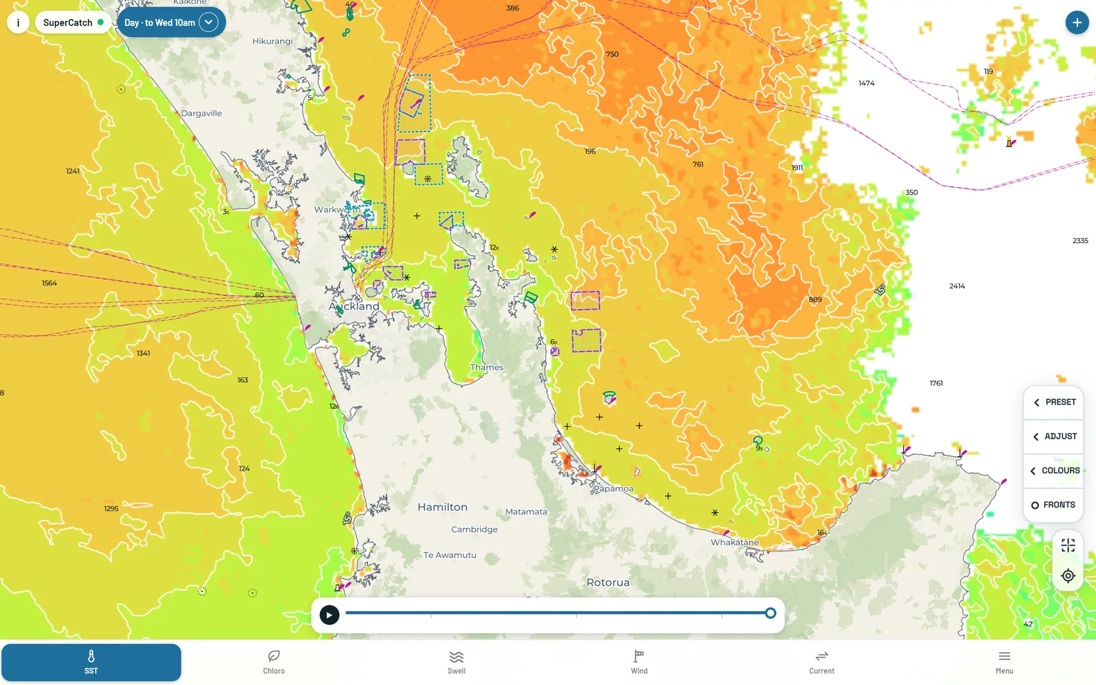
SuperCatch on a desktop screen: the 24-hour sea temperature blend with the play control and time slider
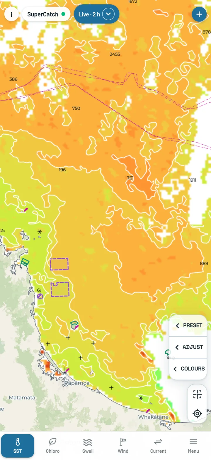
SuperCatch on a phone showing SST Live, this hour's sea temperature
What you get

Everything a skipper reads before and during a day on the water.

One layer at a time along the bottom of the screen - SST, Chloro, Swell, Wind, Current - over a marine chart in New Zealand waters. Tap anywhere for the reading.

Sea temperature

This hour's water, at 2 km.

SST Live is a fresh picture from the Himawari-9 satellite every hour, day and night. SST Day blends the last 24 hours into one clean picture, with play and a slider to step back three days hour by hour. SST Stable is a complete, gap-free daily analysis for the broad view.

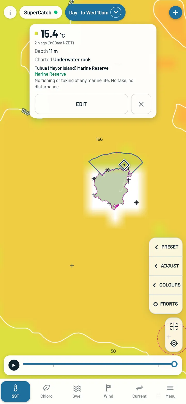
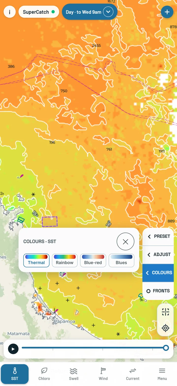
One colour for every half degree, from purple in the coldest water to a strong red in the warmest, with isotherms that thin out as you zoom out. Preset, Adjust and Colours sit on the right of the map, one tap each.
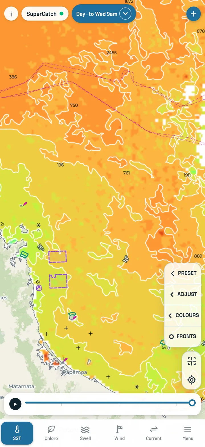
SST Day: the 24-hour sea temperature blend with its time slider
Colours open beside the map on SST: the four colour choices, one tap
Chloro

Where the green water is, at 1 km.

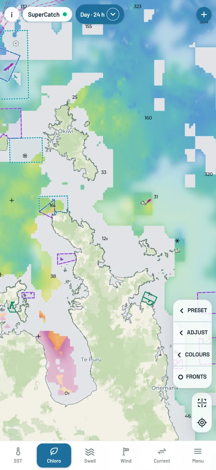
Chloro Day is one sharp New Zealand picture a day, built from Sentinel-3 ocean colour at about 1 km wherever it saw clear water, with Himawari filling the gaps. Chloro Live is a new picture every daylight hour; after dark it keeps the evening's last one and tells you how old it is.

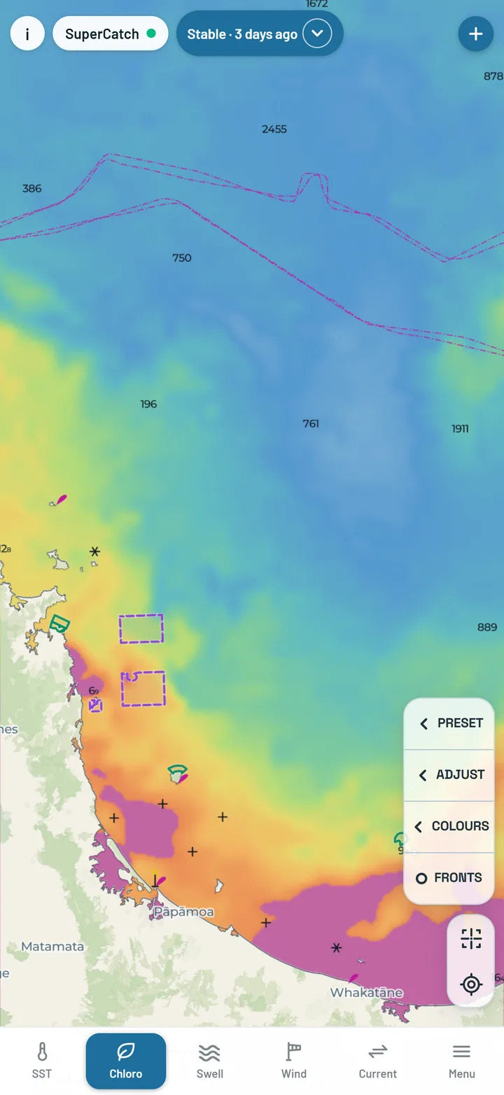
Chloro Stable is the complete gap-free picture, about two days behind. Every version stops at the edge of the palest chart band, about 30 m - closer in, the seabed and runoff colour the reading. Grey means no reading: cloud, or too close to land.

Chloro Day: a sharp chlorophyll picture around New Zealand
Chloro Stable: the gap-free chlorophyll analysis
Sea height & wind

Know what it will be like out there.

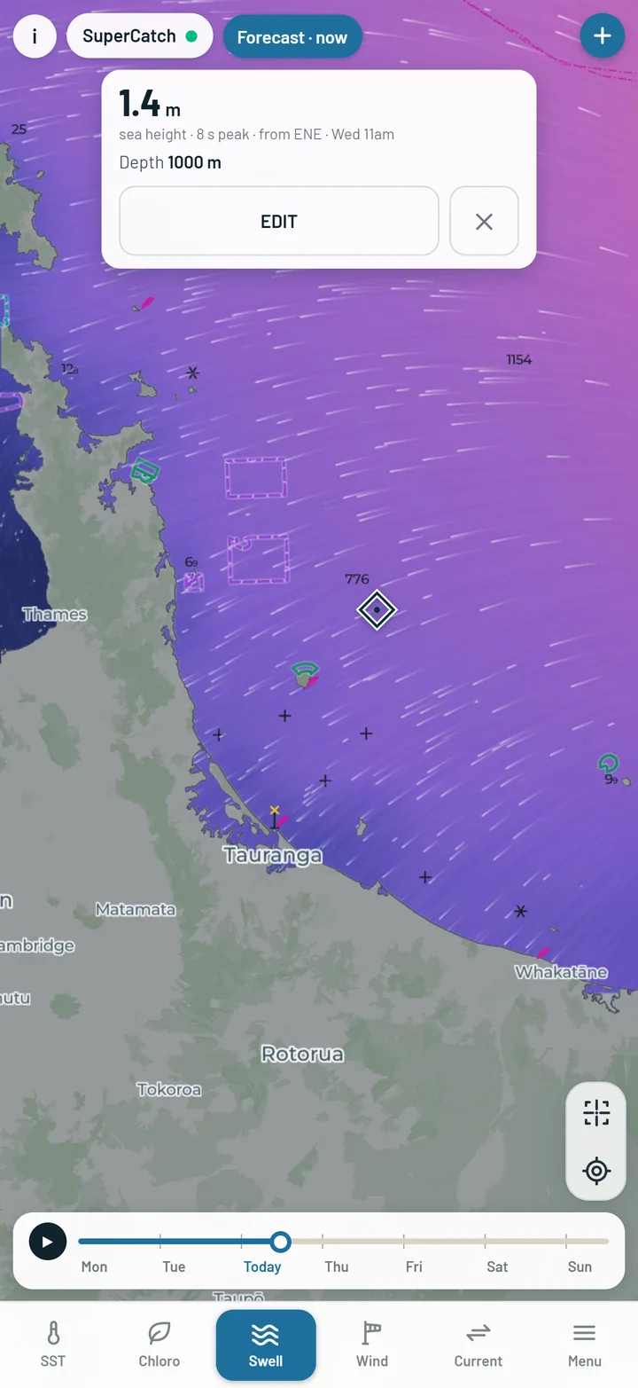
Sea height is swell and wind chop together, in metres, from two days back to four days ahead. Tap anywhere for the sea height there; every catch you log records the sea height and the primary swell.

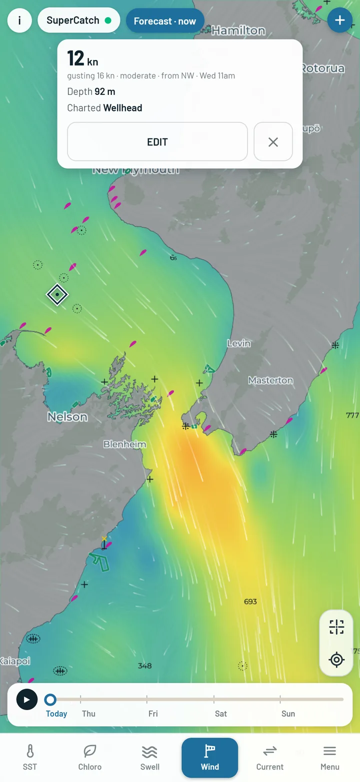
Wind runs from now to four days ahead with moving particles, and the card tells you what it is gusting. The pill at the top turns red when the wind at the map centre is over 25 knots.

Sea height on the map with the reading card open
Wind particles over the map with the card showing the gust
The chart

A real marine chart under every layer - in New Zealand.

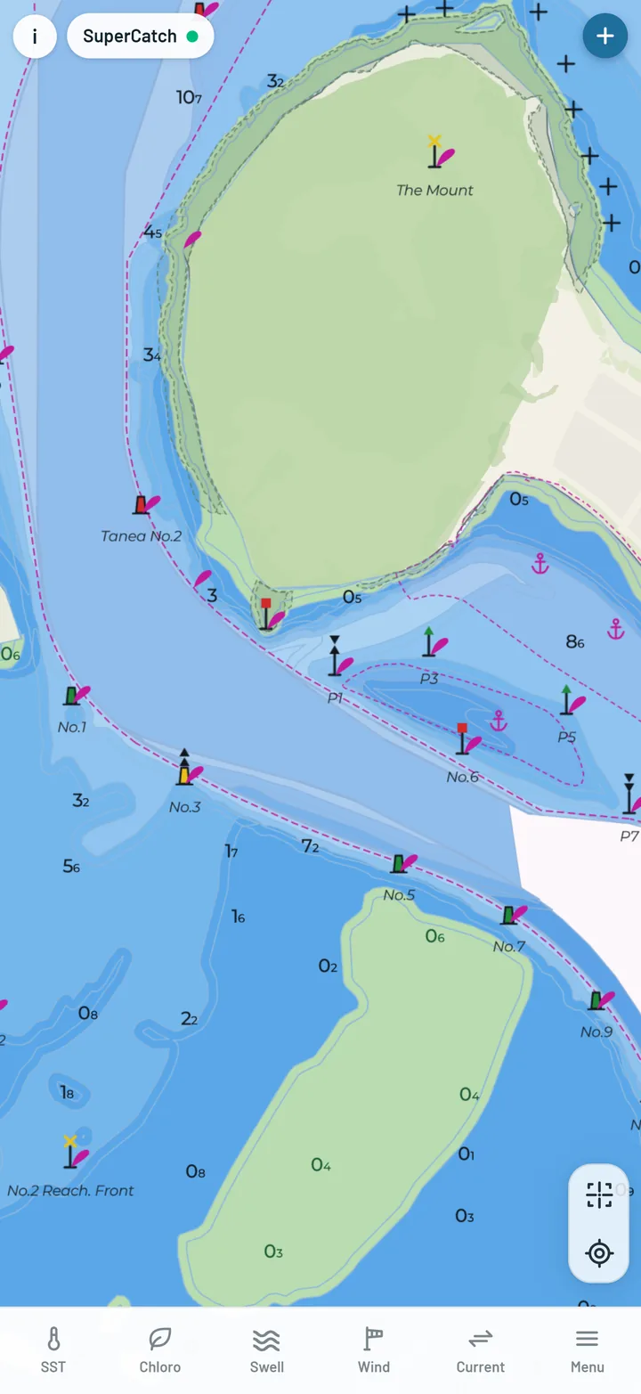
Depth contours from LINZ charts inshore and NIWA offshore, LINZ soundings, depth bands, seabed type, cables, and chart hazards - rocks, wrecks, obstructions, lights and buoys in standard chart symbols.

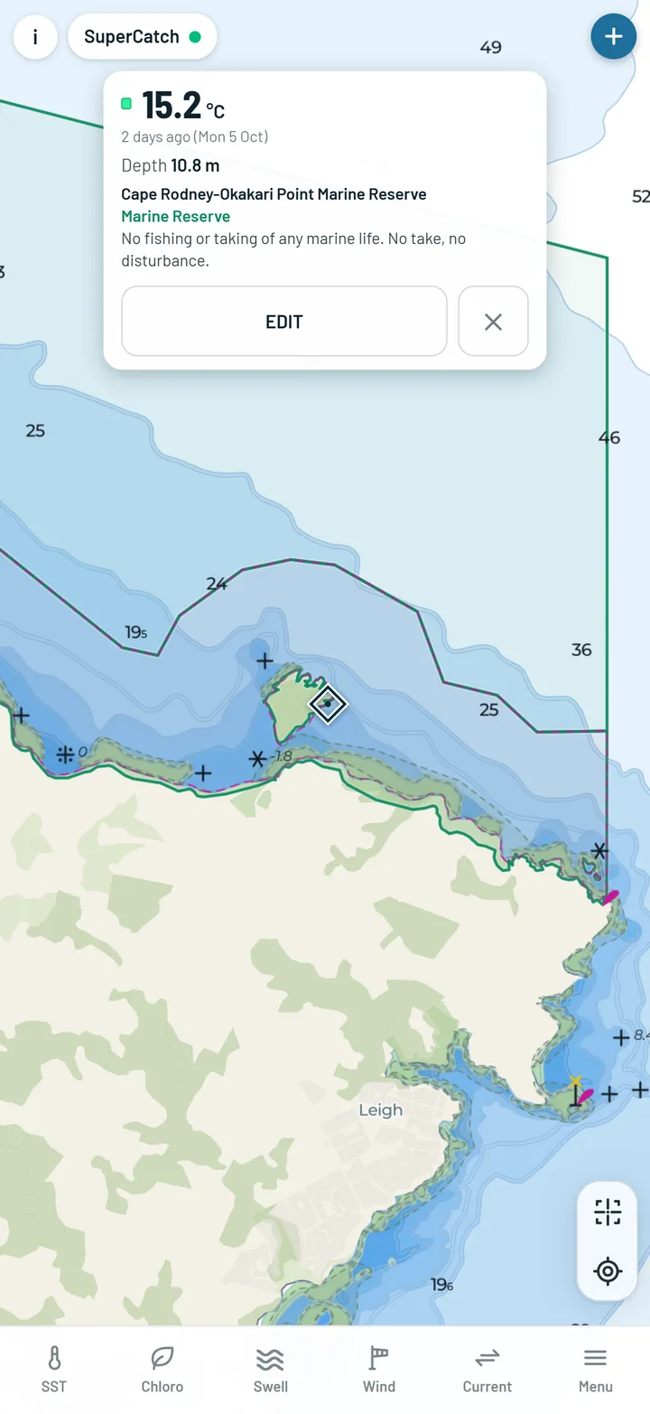
New Zealand's marine reserves and protected areas are drawn, and a tap brings up their rules.

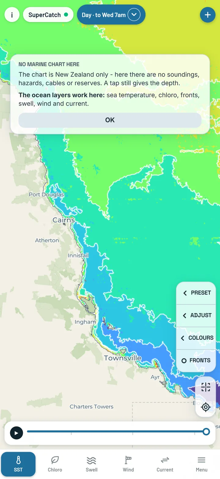
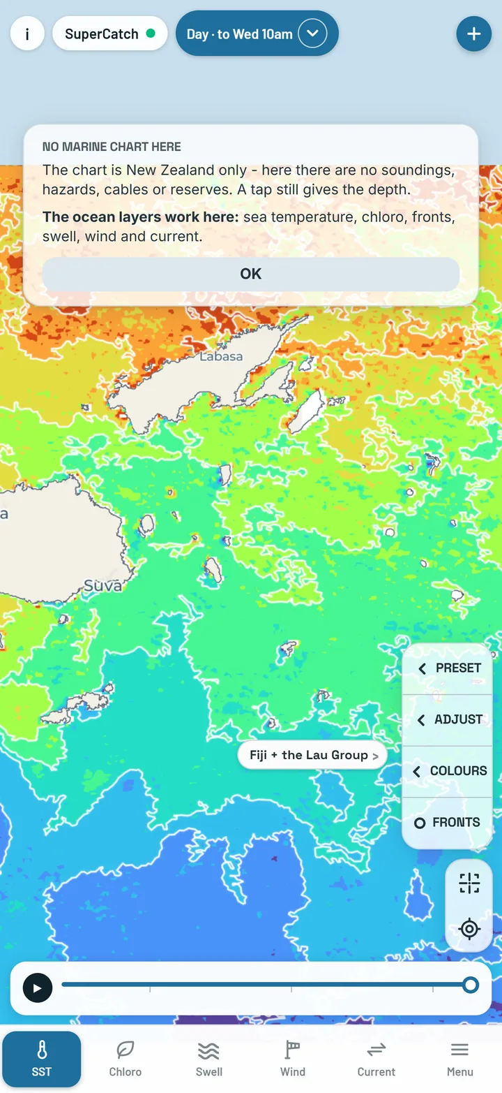
The chart is New Zealand only. The charted depths and coastline come from LINZ, which covers New Zealand waters and nothing else. In Australia and the Pacific there is no marine chart: a tap gives a rough depth (west of 180° - past it, around the Lau Group, there is none), and in Western Australia the lights and buoys are drawn - that is all. The ocean layers - sea temperature, chloro, fronts, swell, wind and current - work in Australia and the Pacific from Lord Howe to Fiji as well as New Zealand. Chloro Day is New Zealand only, and SST Stable stops at 180° - it does not reach the Lau Group.

The chart with rocks, wrecks, lights and buoys in INT-1 symbols
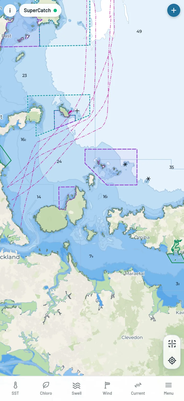
The chart with depth bands switched on
A marine reserve tapped, with its rules on the card
One tap

Tap anywhere for the full reading.

The card shows the layer's own reading, the depth, and what is charted there - reserve, cable, hazards.

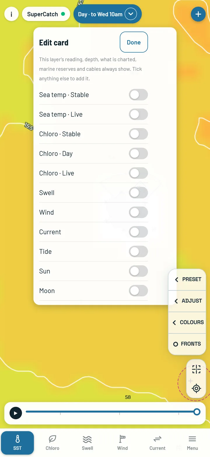
Tap EDIT to add any other reading - sea temperature or chloro (Live, Day or Stable), swell, wind, current, tide, sun and moon. What you tick waits behind MORE on every tap.

The reading card after a tap: the reading, the depth and what is charted there
The card's EDIT switches for sea temperature, chloro, swell, wind, current, tide, sun and moon
Catch log

Every catch, with the water it came from.

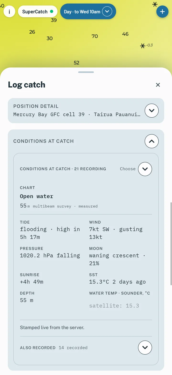
Tap +, drop the pin, and the conditions are stamped on the spot - every version of sea temperature and chloro, water clarity, sea height and swell, wind and gust, current, pressure, tide, moon, sun, depth and club square. With no signal the catch still saves; wind, pressure and sea temperature fill in when you're back in range.

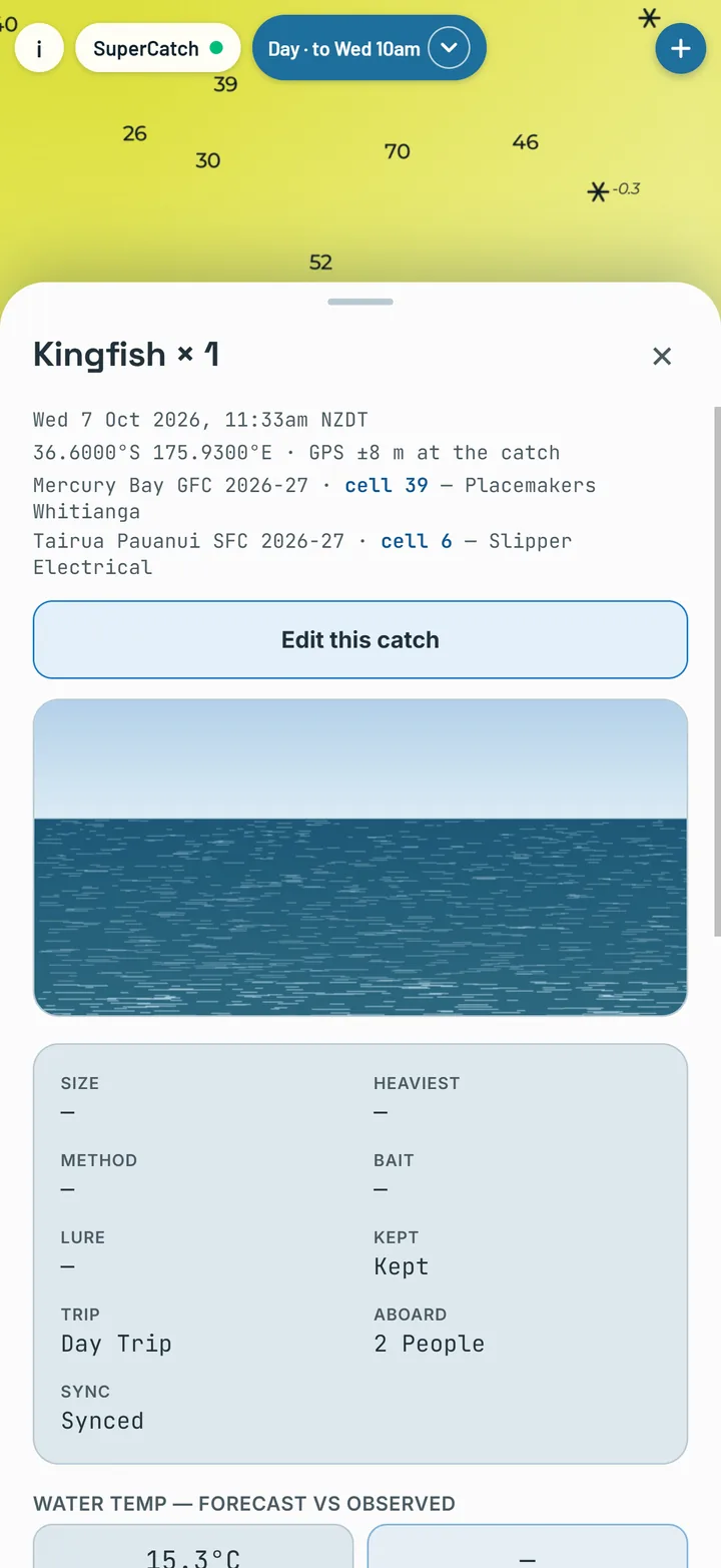
Add the species, a photo and a voice note. In New Zealand the MPI size and bag limits for the area are right there as a guide.

Logging a catch: the conditions stamped at that moment
A saved catch with its species, photo and conditions
Club grids

Your club's grid, on the map.

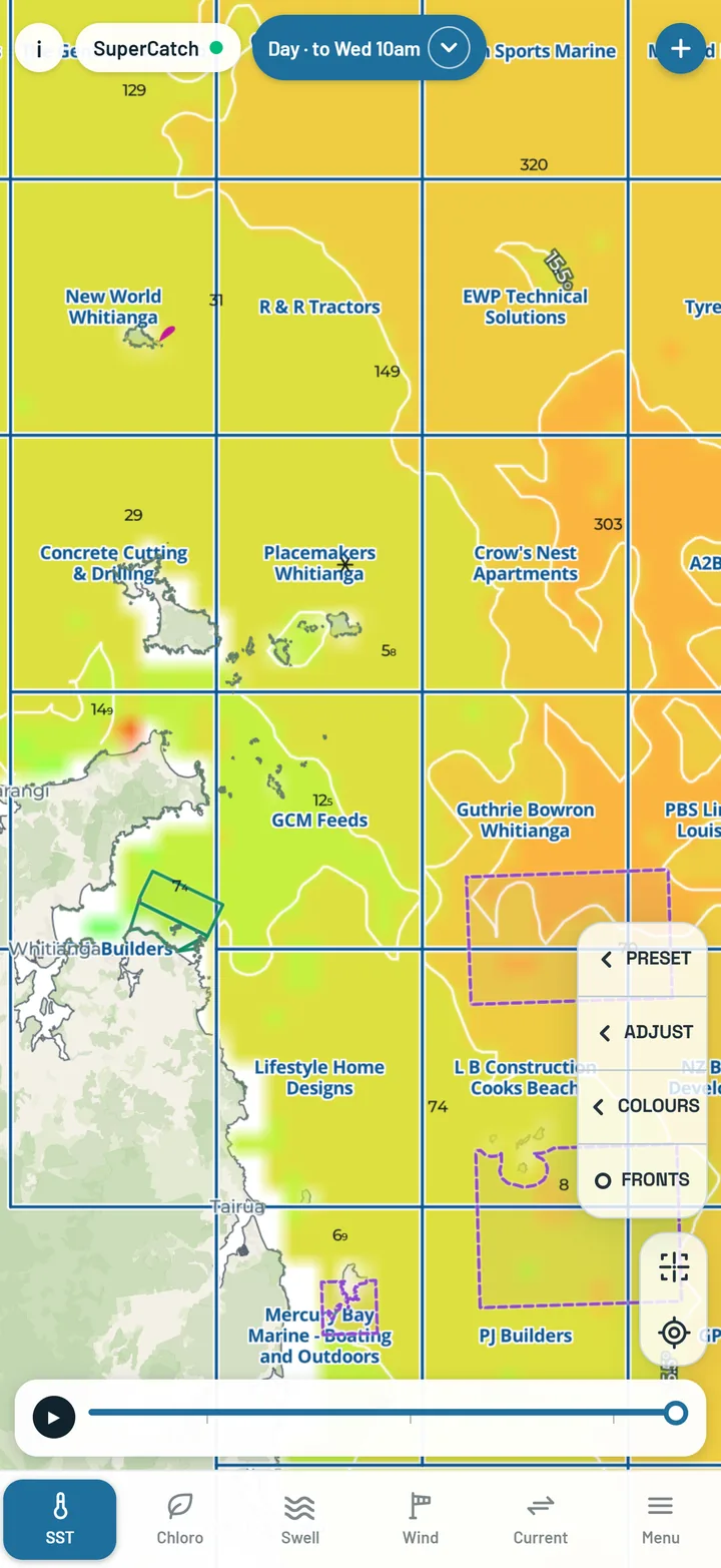
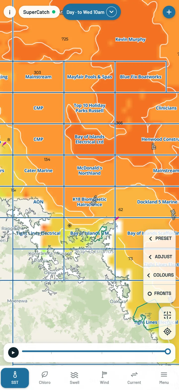
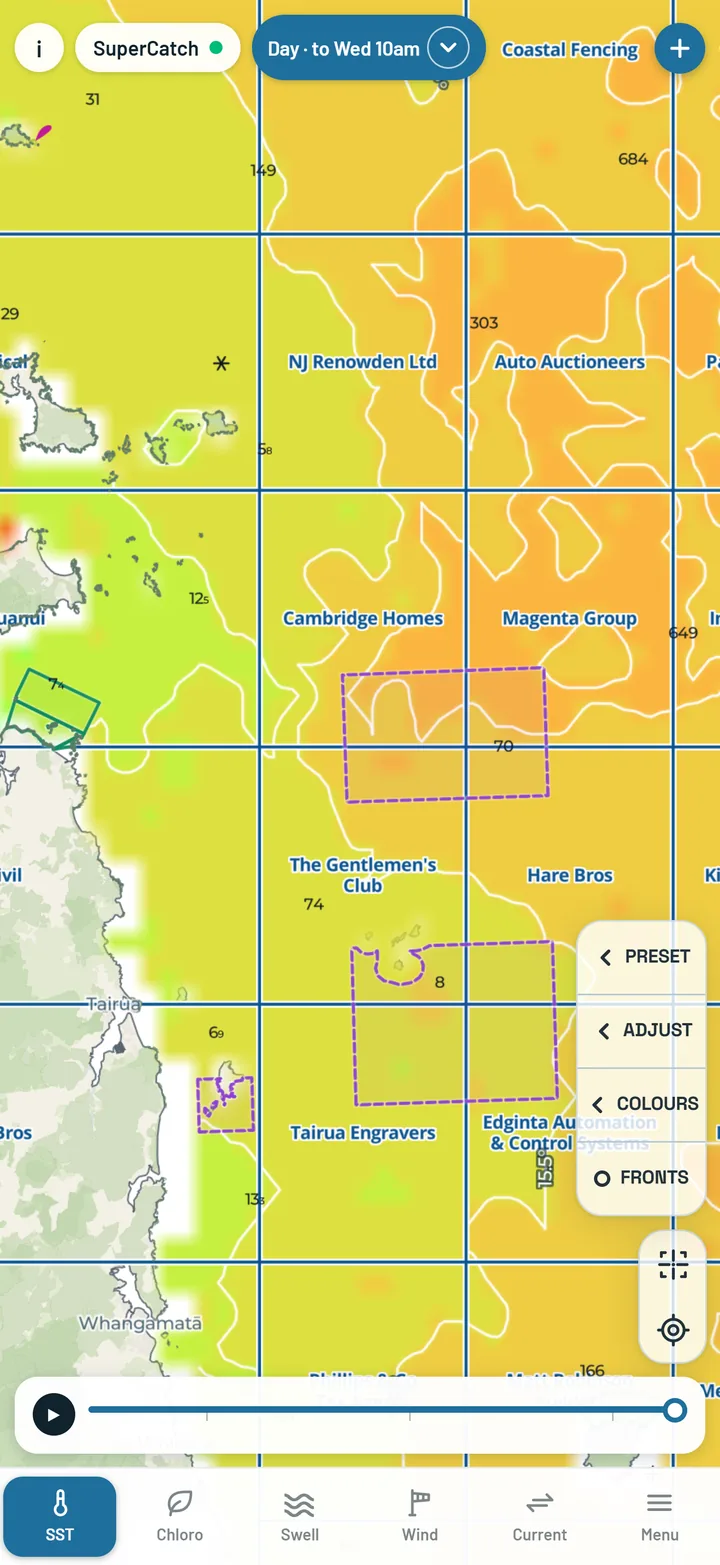
Mercury Bay Game Fishing Club 2026-27, Tairua Pauanui Sports Fishing Club 2026-27 and Bay of Islands Swordfish Club 2026. Sponsored squares carry the sponsor's name, the chip shows the square you are in, and every catch is stamped with its square for every grid - drawn or not.

Mercury Bay Game Fishing Club grid with sponsor names on the squares
Mercury Bay
Bay of Islands Swordfish Club grid
Bay of Islands
Tairua Pauanui Sports Fishing Club grid
Tairua Pauanui
Coverage

Fifteen boxes of hourly sea temperature.

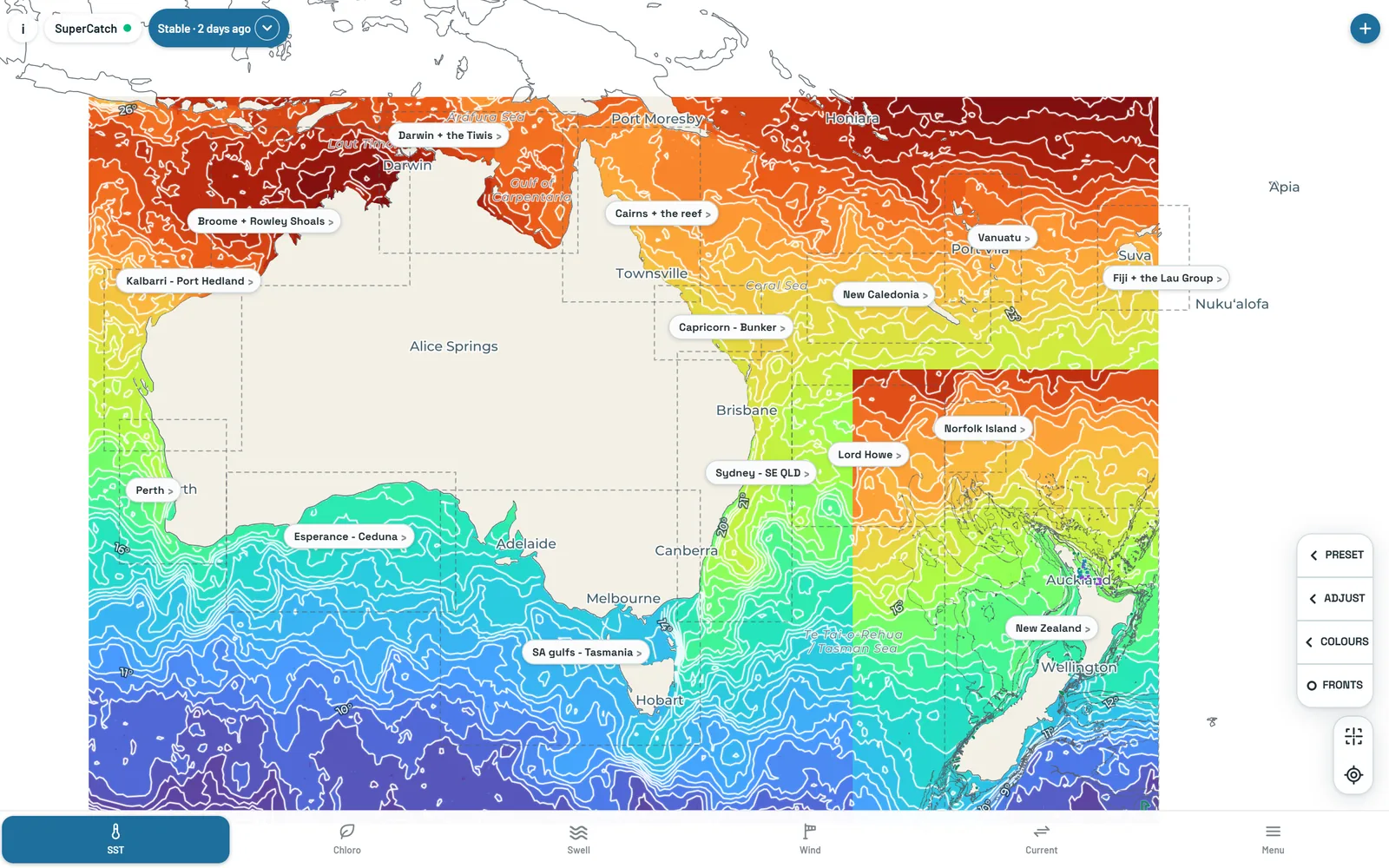
SST Live and SST Day cover New Zealand and fourteen more boxes: nine around Australia and five in the Pacific, from Lord Howe to Fiji. The box in the middle of the map is the one painted, coloured on its own water - all of New Zealand is one box on one scale - and every box keeps its own local time. Water outside every box is plain light blue. Swell and wind reach east to Fiji and Tonga.

  • New Zealand
  • Cairns + the reef
  • Darwin + the Tiwis
  • Broome + Rowley Shoals
  • Kalbarri – Port Hedland
  • Perth
  • Capricorn – Bunker
  • Sydney – SE QLD
  • SA gulfs – Tasmania
  • Esperance – Ceduna
  • Lord Howe
  • Norfolk Island
  • New Caledonia
  • Vanuatu
  • Fiji + the Lau Group
The coverage boxes across New Zealand, Australia and the Pacific on a desktop screen
Sea temperature over Cairns and the Great Barrier Reef
Sea temperature around Fiji and the Lau Group
Works offshore

Take the water with you.

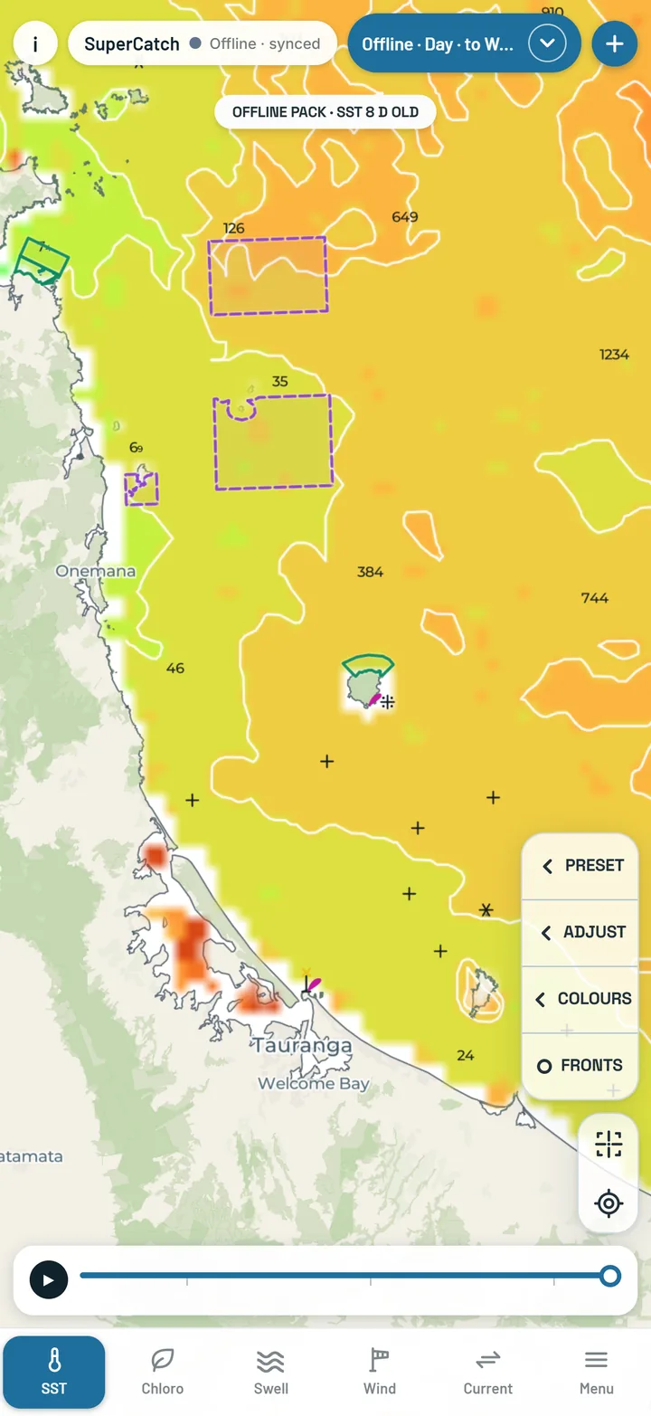
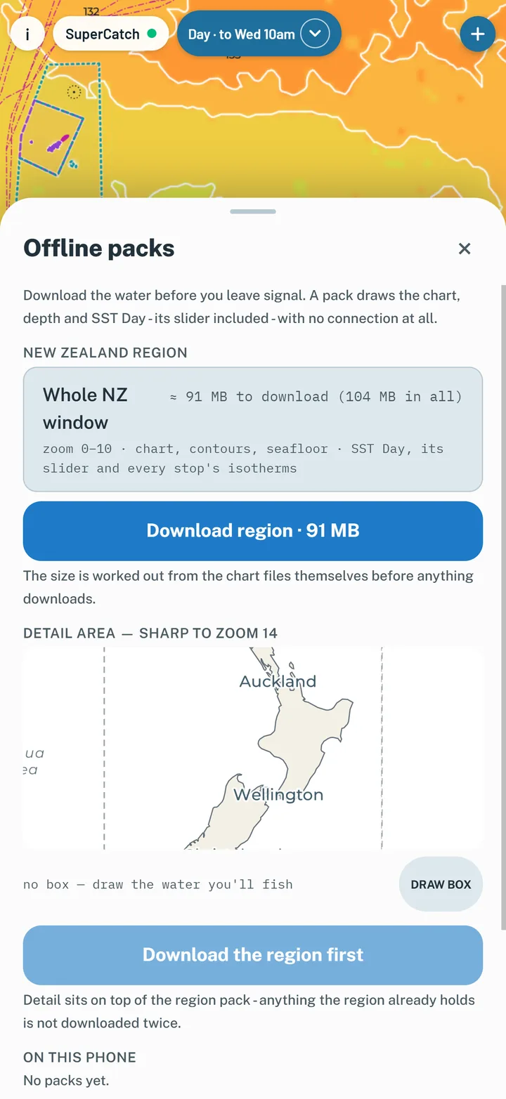
Menu → Take it offshore downloads offline packs before you leave signal: the chart, contours and seafloor for the whole of New Zealand, SST Day with its slider and isotherms, and a sharper detail box over the water you will fish. Packs are New Zealand only.

  • The size is shown before anything downloads
  • Packs refresh their SST in the background whenever there is signal
  • Catches log with no signal; the weather fills in when you're back in range
The map working offline from a downloaded pack
The offline packs sheet: New Zealand region and a detail box
Pricing

Two plans, bought by the month. Nothing renews.

You need an account and a plan to use the app - the chart included. Ocean includes everything in Chart. Buying plans opens after testing. Until then, plans are switched on by us: club testers, start here.

Where each plan works. Chart is New Zealand only - the marine chart is LINZ's, and it covers New Zealand waters and nothing else. Ocean works everywhere SuperCatch covers - New Zealand, Australia and the Pacific from Lord Howe to Fiji: sea temperature, chloro, fronts, swell, wind and current are not limited to New Zealand waters. Chloro Day is New Zealand only, and SST Stable stops at 180° - it does not reach the Lau Group. Fishing outside New Zealand? Ocean is your plan.

Chart

NZ$5 / month
NZ$40 for twelve months - two months free

The chart, the weather and your catch log, for New Zealand waters. The chart is New Zealand only - outside New Zealand there is no marine chart, so Chart buys nothing useful there. Fishing outside New Zealand? Choose Ocean.

  • The New Zealand chart: LINZ and NIWA contours, soundings, depth bands and seabed type
  • Chart hazards, cables, marine reserves and their rules
  • Tide times from LINZ ports
  • Sea height and swell, two days back to four ahead
  • Wind and gusts, four days ahead
  • Surface current
  • Catch log with conditions stamped, photos and voice notes
  • Trips, Marks and Fish counter
  • Club grids
Sign up

Prices are in New Zealand dollars and include GST. Twelve months of Chart bought together are NZ$40 instead of NZ$60. When buying opens you buy months upfront - this month and up to twelve ahead - and nothing renews or charges you again. A month that has not started can be refunded. See the terms.

Get the app

On your phone, or in your browser.

Club testers on iPhone use the iPhone app through Apple's TestFlight (iPhone 11 or newer on iOS 26) - the testers page has the steps. Everyone else, and Android, opens SuperCatch at supercatch.co.nz/app on any phone, tablet or computer. Add it to your home screen and it opens full screen like any other app.

iPhone and iPad

  1. Open the app in Safari
  2. Tap Share
  3. Tap Add to Home Screen

Android

  1. Open the app in Chrome
  2. Tap the ⋮ menu
  3. Tap Install app, or Add to Home screen
SuperCatch running full screen on a phone: SST Live over the Hauraki Gulf

See today's water.

Sign up and the map is yours once your plan is on - sea temperature, chloro, sea height, wind and the chart, wherever you fish.